


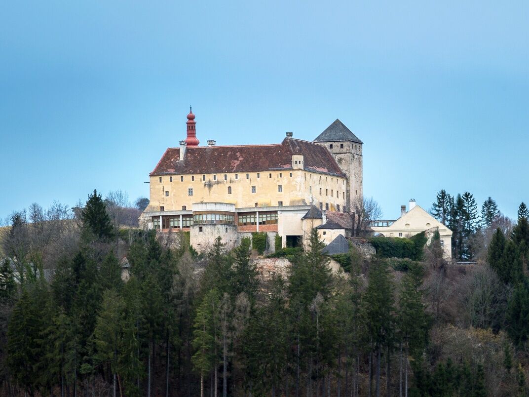
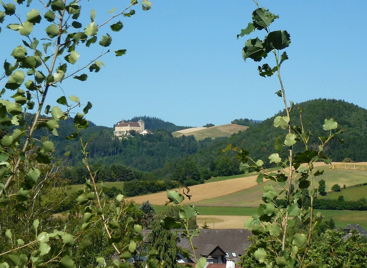
Hike Castle - Prägart
You can explore and enjoy the Bucklige Welt on this pleasant circular hike. At comfortable heights, you can relax in the fresh air and take in nature and the beautiful surroundings. Over field and forest...
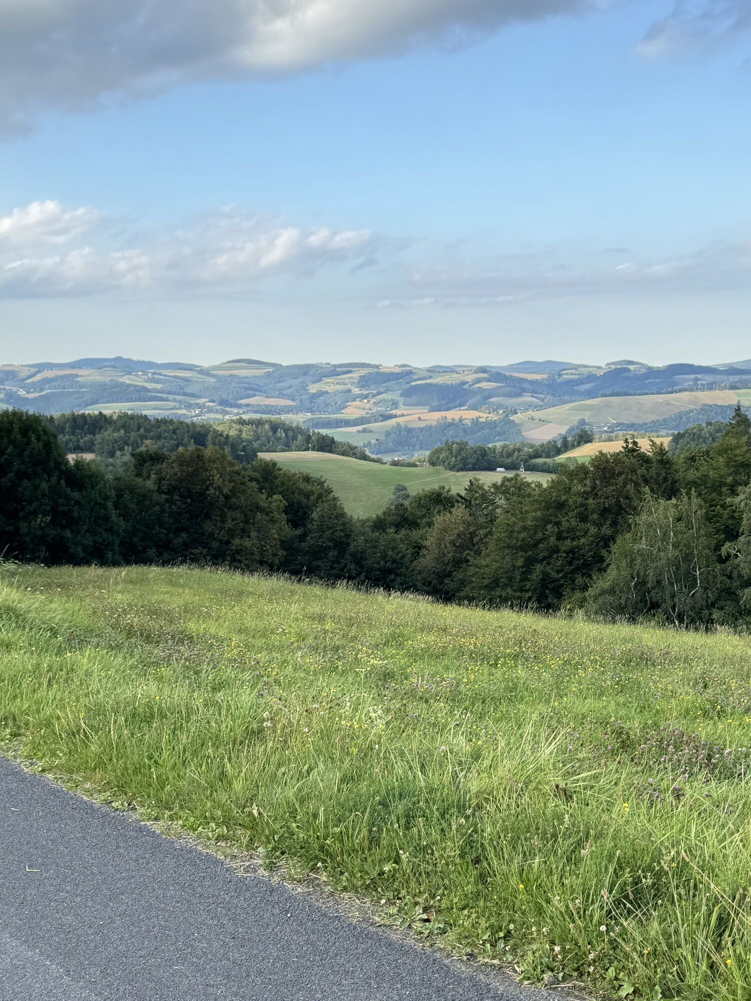
<p>You can explore and enjoy the Bucklige Welt on this pleasant <strong>circular hike</strong>. At comfortable heights, you can relax in the fresh air and take in nature and the beautiful surroundings. Over field and forest paths, you walk lightly uphill from Schloss Krumbach, near the <strong>Steinkreis viewpoint</strong>, with a wonderful view of the <strong>hilly landscape of the Bucklige Welt</strong> around Krumbach. The start of the hike is the <strong>Schlosswirtshaus</strong> at about 600 meters elevation. After the hike, you can recharge here, or look down towards Krumbach. Within less than an hour of walking, you reach the <strong>Gasthof Heissenberger,Piri's Gasthaus</strong> or <strong>Krumbacherhof</strong>. If you have reserved in advance, you can also indulge yourself culinarily at the nearby <strong>Triad</strong>.</p><p>From the castle, there are many hiking opportunities, for example on a regional route of the Path at the Vienna Alpine Arc.</p>

<p>The starting point is at the Schlosswirtshaus. From there, follow the orange marking. It goes straight uphill over Feichten Street through Haselgraben. At the intersection, turn right and continue following the path number 13. At the next fork in the road, keep left to reach Prägart. Follow the path downhill until after about 1.5 kilometers you turn left onto a path that leads back to the Schlosswirtshaus.</p>
<p>Always take suitable <strong>maps</strong> with you. Wear sturdy <strong>shoes</strong> appropriate for the route, take sun and rain protection as well as water and a snack. Bring your <strong>mobile phone</strong> and save the mountain rescue emergency number: 140</p>
<p>Your hikes in the Vienna Alps should be a pleasant and safe experience overall. Please note the following:</p><p><strong>Preparation</strong></p><p>Make sure, when choosing a route, that it matches your experience and <strong>fitness</strong>. Check the <strong>weather forecast</strong> beforehand. Weather in the mountains can change suddenly and rapidly. Therefore, always set out equipped accordingly (e.g., rain protection).</p><p>Check if the <strong>huts and snack stations</strong> you want to visit on the way are open. <strong>Inform</strong> someone about your chosen route and your planned return before you leave.</p><p>More safety tips for your hike can be found <a href="www.wieneralpen.at/sicherheit-am-berg...
<p><strong>From Vienna:</strong> Take the Südautobahn A2, exit at Krumbach. Continue on the Krumbach junction. Continue on Kirchschlager Str./B55. Turn right onto L137. Slight left over the bridge onto Schlossstraße, follow until Schlosswirtshaus.</p><p><strong>From Graz:</strong> Take the Südautobahn A2, exit at Aspang-Zöbern. Turn right onto L137. Continue on Kampichl and Hauptstraße. Hauptstraße turns left in Zöbern and becomes Austraße. Follow L137 to Unterhaus near Krumbach and sharply turn right onto Schlossstraße. Continue to Schlosswirtshaus.</p>
<p>More information can be found at <a href="www.vor.at">www.vor.at</a> and <a href="www.oebb.at">www.oebb.at</...
<p>Parking spaces are available at the Schlosswirtshaus.</p>
Vienna Alps in Lower Austria, www.wieneralpen.at, +43 / 2622 / 78960
Opening hours: Mon - Thu 08:30 - 16:00 / Fri 08:30 - 13:00
Adventure region Bucklige Welt South, www.buckligewelt.info, +43 / 676 3509806
Use the nearby Krumbacherhof also for accommodation.
Further dining options can be found under "Description".
Popularne wycieczki w okolicy
- 4,1
"Weg der Blicke"
światłoWędrówka 5,86 km - 4,5
Bad Schönau - Hutwisch
światłoWędrówka 9,99 km - 4,6
Mönichkirchner Genussrunde
światłoWędrówka 10,1 km - 4,4
BAD-SCHÖNAU Hutwisch und wieder zurück 20220611
średniWędrówka 10,8 km - 4,4
B53 Edelserpentin
średniJazda na rowerze 23,5 km - 4,8
Bakabu children's adventure trail to Hutwisch
średniTrasa tematyczna 5,42 km - 4,4
Hochegger Höhenweg
światłoWędrówka 4,55 km - 4,5
Hallerhaus - Runde
Wędrówka 4,47 km - 4,8
B41 Zöberntal-Rabnitztal cycle trail
średniJazda na rowerze 40,7 km - 5,0
Hilmtor-Runde, Friedberg
średniWędrówka 12,2 km
Wędrówki i tropienie


Nie przegap ofert i inspiracji na następne wakacje
Twój adres e-mail została dodana do listy mailingowej.