© Wienerwald Tourismus GmbH / Christoph Kerschbaum
- Krótki opis
-
Zur Hälfte ein attraktiver Berg-Trail, zur Hälfte eine rasante Gleitstrecke-dazwischen das Naturjuwel Steinwandklamm mit seinem Eisensteig und zwei Höhlen. Ein großartiges Voralpen-Potpourri für Biker und Hiker.
- Stopień trudności
-
ciężkie
- Ocena
-
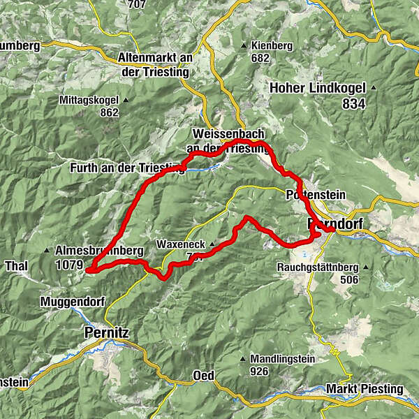
- Trasa
-
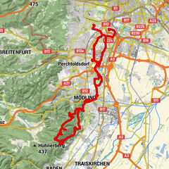
Berndorf (314 m)Steinhof3,7 kmPöllau4,8 kmAm Kaar (775 m)10,7 kmWaxeneckhaus10,9 kmAuf dem Hals (662 m)12,8 kmSchneerosenhaus12,9 kmGasthaus Jagasitz16,4 kmReischer Jausenstation17,4 kmAuerhahn-Halbhöhle20,8 kmGasthof "Zum Auerhahn"20,8 kmWohnkammerl21,0 kmGrabenweger Kapelle21,3 kmSchromenau22,4 kmGasthof zum Furtherwirt (Fam. Reischer)22,4 kmMaierhof23,1 kmLerchenfeld23,9 kmNiemtal25,5 kmHerz-Jesu-Kirche26,8 kmWeissenbach an der Triesting27,1 kmPetra`s Stüberl27,5 kmWeissenbach-Neuhaus27,8 kmFahrafeld29,3 kmLuftschutzloch32,0 kmRadling33,2 kmPottenstein33,4 kmBerndorf (314 m)35,5 km
- Najlepszy sezon
-
stylutmarkwimajczelipsiewrzpaźlisgru
- Najwyższy punkt
- 793 m
- Miejsce docelowe
-
Berndorf beim Bahnhof
- Profil wysokości
-


- Autor
-
Wycieczka Steinwandklamm-Strecke jest używany przez outdooractive.com pod warunkiem.
GPS Downloads


Informacje ogólne
Przystanek odświeżania
Wskazówka dla osób mających dostęp do poufnych informacji
Więcej wycieczek w regionach