Seetal Heart Loop (West Branch ) – SwitzerlandMobility Route 599

Jazda na rowerze


- Krótki opis
-
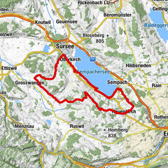
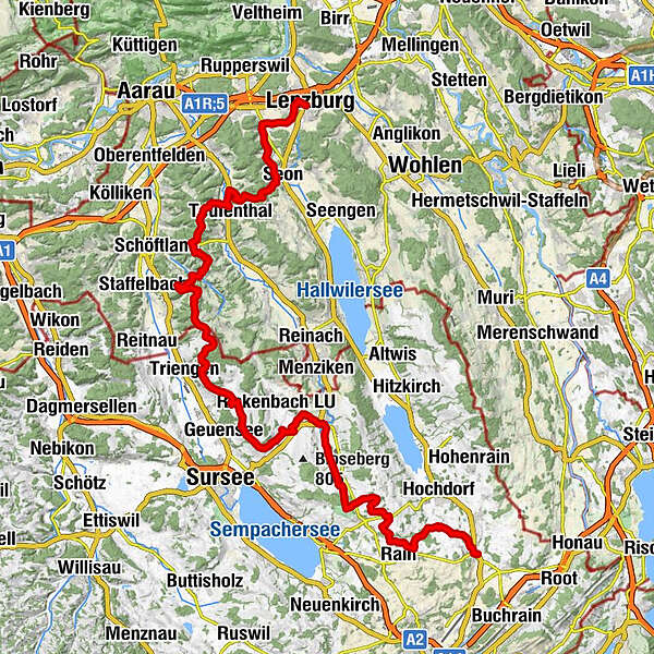
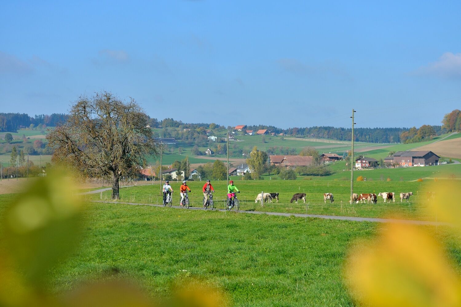
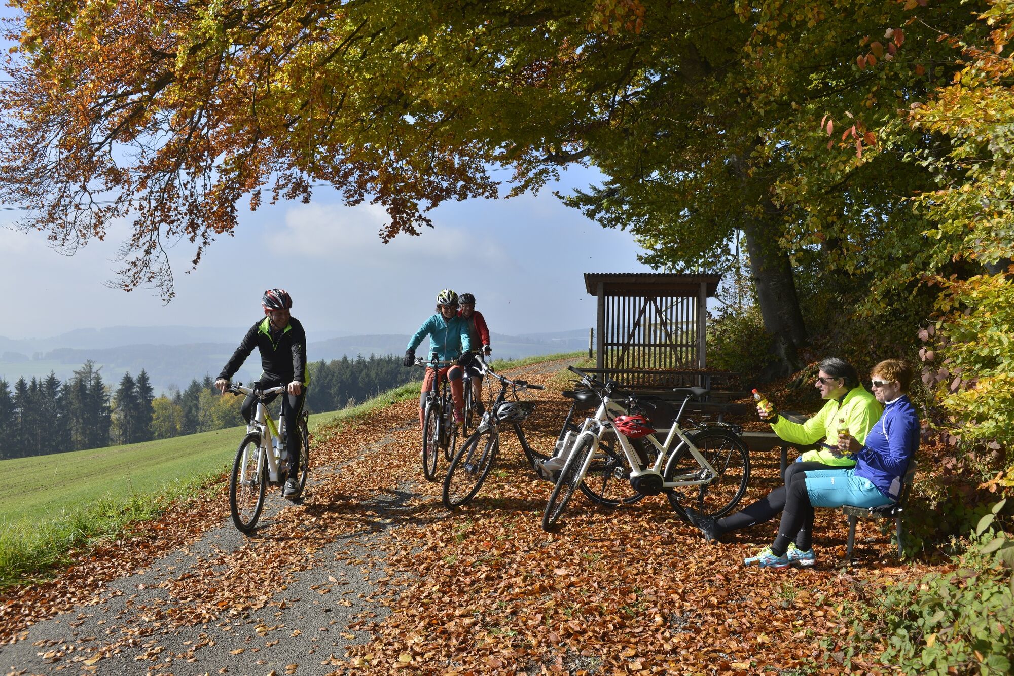
The 116 km Seetal Heart Loop offers two wonderful one-day stages away from traffic: the charming 51 km “East Branch” e-bike stage passes through traditional orchards and over the Lindenberg with views of Lakes Baldegg and Hallwil, as well as of the breathtaking alpine panorama. The 65 km “West Branch” immerses you in the green valleys and hills of Canton Aargau and the Beromünster – Lake Sempach region.
- Stopień trudności
-
ciężkie
- Ocena
-
- Trasa
-
Lenzburg (407 m)StadtkircheKatholische Kirche Herz Jesu0,4 kmStaufen (420 m)1,4 kmIm Herme2,1 kmRef. Kirche Schafisheim3,3 kmEintr83,5 kmSchafisheim (415 m)3,5 kmSeon (445 m)7,1 kmLiebegg12,1 kmTeufenthal (446 m)13,2 kmWannenhof16,0 kmRestaurant Wannenhof16,0 kmSchlossrued (497 m)21,1 kmGasthof Storchen21,1 kmWellnau (697 m)31,1 kmSchlierbach (701 m)33,5 kmKrumbach (686 m)35,7 kmHunzikon37,3 kmBuholz37,9 kmHoldern39,2 kmSaffental40,1 kmGunzwil (666 m)43,0 kmBeromünster (644 m)44,2 kmMürgi47,4 kmNeudorf (670 m)47,6 kmGormund50,8 kmElmenringen51,0 kmKapelle Antonius54,2 kmTraselinge54,5 kmOhmelinge55,3 kmHerzige57,5 kmHerbrig58,3 kmUrswil61,2 kmEschenbach64,1 kmHof Beiz64,1 kmLöwen64,4 kmEschenbach LU (468 m)64,5 km
- Najlepszy sezon
-
stylutmarkwimajczelipsiewrzpaźlisgru
- Najwyższy punkt
- 760 m
- Miejsce docelowe
-
Eschenbach, railway station
- Profil wysokości
-
 © outdooractive.com

- Autor
-
Wycieczka Seetal Heart Loop (West Branch ) – SwitzerlandMobility Route 599 jest używany przez outdooractive.com pod warunkiem.
GPS Downloads


Informacje ogólne
Przystanek odświeżania
Więcej wycieczek w regionach
-
Kanton Aargau
196
-
Wynental
70
-
Burg AG
24