


The Pizzi loop
The proposed loop was born from the collaboration between the Sondrio section of the C.A.I. and the Scientific High School of Sondrio "Carlo Donegani" which led to the marking and enhancement of an interesting...
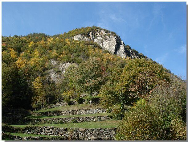
La Scala dei Pizzi represented the only connection between the ancient quadre of Torre and the valley. It was also used by shepherds as a mule track.
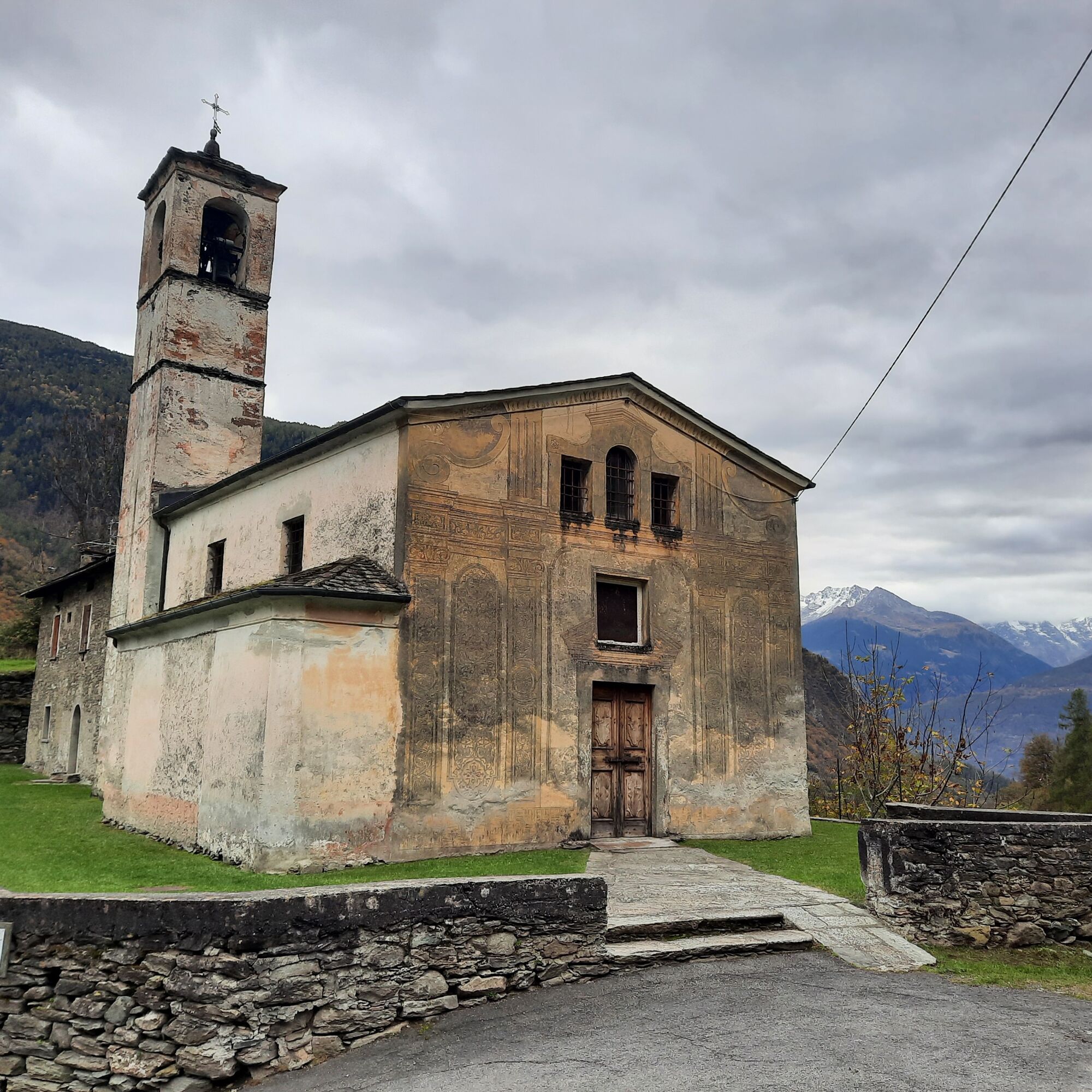
Pizzi has been inhabited since prehistoric times but began to take on the characteristics of a village with stable settlements around 1200 AD. The functions this small district assumed were mainly of defense due to the frequent raids once common in the valley floor.
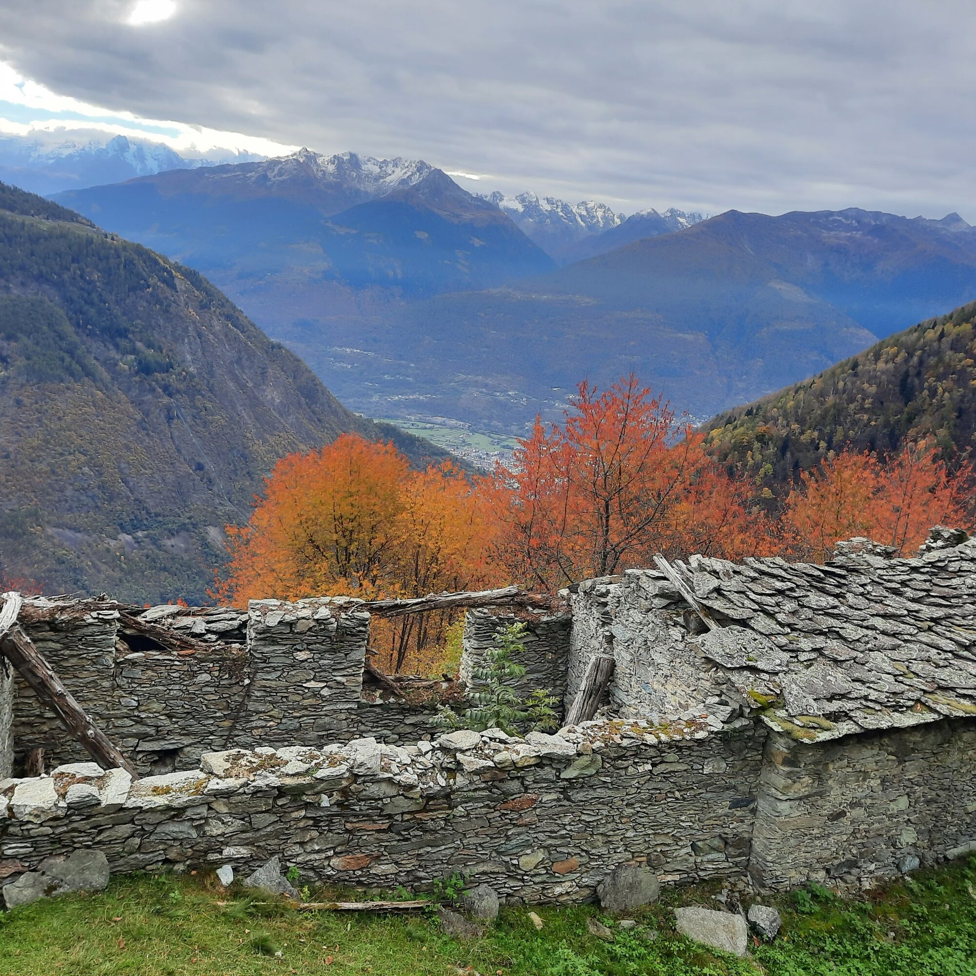
Another interesting village encountered on this route is Prà Marsciana: a balcony over Valmalenco from which it is possible to admire Bernina and other peaks such as Roseg, Cresta Guzza, Scerscen and Argent. Finally, there is a beautiful view of Sondrio, Ponchiera and the Orobie.
Ponte stazione, Sazzo, Arigna, Centrale di Armisa, Foppe, Prataccio in Val d'Arigna - return to Ponte stazione
La Scala dei Pizzi, before the advent of drivable roads, was the only connection between the ancient quadre of Torre (in medieval times they were the districts). It was also used by shepherds as a mule track
Kamery internetowe z trasy
Sondrio - Piazza Garibaldi
Chiareggio
Dal Rifugio del Grande - Camerini
Dal Rifugio Zoia
Valmalenco Ski area: Campo scuola
Valmalenco Ski area: pista Thoeni
Lago Palù
Massiccio del Disgrazia
Vallata di Chiareggio e San Giuseppe
Valmalenco Ski area: Alpe Palù
Valmalenco Ski area: Ascensore inclinato
Valmalenco Ski area: seggiovia Bocchel del Torno
Popularne wycieczki w okolicy
- 5,0
Palu' Lake, a blue pearl in the center of Valmalenco.
średniWędrówka 8,41 km - 4,5
Ghiacciaio Fellaria
światłoWędrówka 5,23 km - 4,0
Capanna Marinelli
światłoWędrówka 8,39 km - 4,5
Porro and Ventina Shelters
światłoWędrówka 3,12 km Alta Via della Valmalenco
ciężkidługodystansowy szlak pieszy 102,5 km- 4,0
Mufule' Lake Ring
średniWędrówka 5,49 km Loop of Lake Gera and Rifugio Bignami
światłoWędrówka 8,25 kmSzlak Valtellina
średniJazda na rowerze 113,2 kmRifugio Bosio-Galli (from Primolo)
średniWędrówka 8,35 km- 5,0
Fusine-Dordona Pass (MTB-EMTB)
światłoMountainbike 20,4 km

Wędrówki i tropienie


Nie przegap ofert i inspiracji na następne wakacje
Twój adres e-mail została dodana do listy mailingowej.