© www.turracherhoehe.at/martin steinthaler - Martin Steinthaler
Dane wycieczki
4,42km
1.766
- 1.831m
71hm
64hm
00:26h

- Krótki opis
-
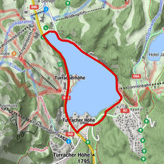
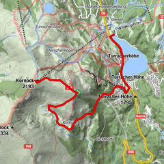
Eine verkürzte Variante der 3-Seen Runde.
- Stopień trudności
-
średni
- Ocena
-
- Punkt wyjścia
-
Turracher See im Bereich Kornockbahn Talstation
- Trasa
-
Christophorus Bergkirche0,5 kmGrünseeblick2,1 kmKarlhütte2,3 km
- Najlepszy sezon
-
stylutmarkwimajczelipsiewrzpaźlisgru
- Najwyższy punkt
- 1.831 m
- Miejsce docelowe
-
Turracher See im Bereich Kornockbahn Talstation
- Mapy
-
Turracher Laufkarte

- Źródło
- TV Turracher Höhe
GPS Downloads


Więcej wycieczek w regionach