
- Krótki opis
-
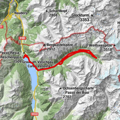
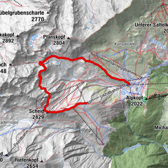
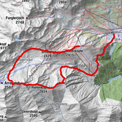
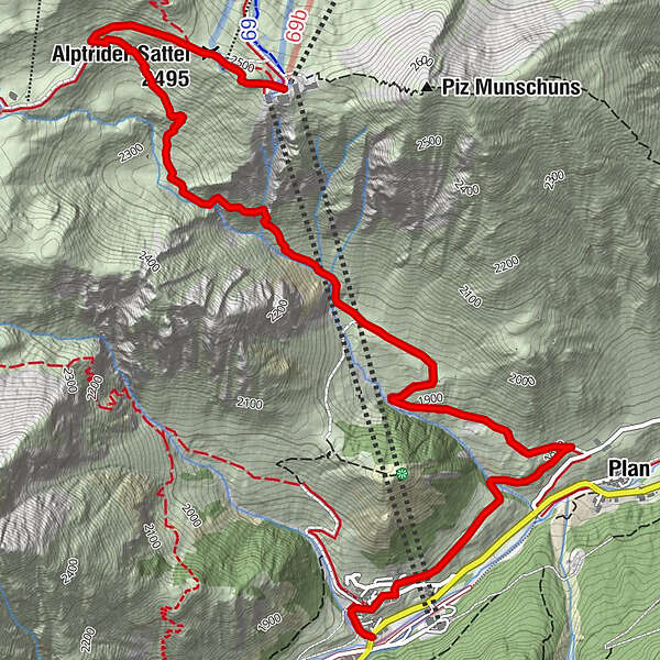
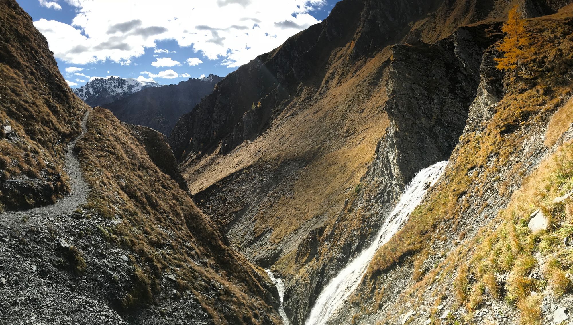
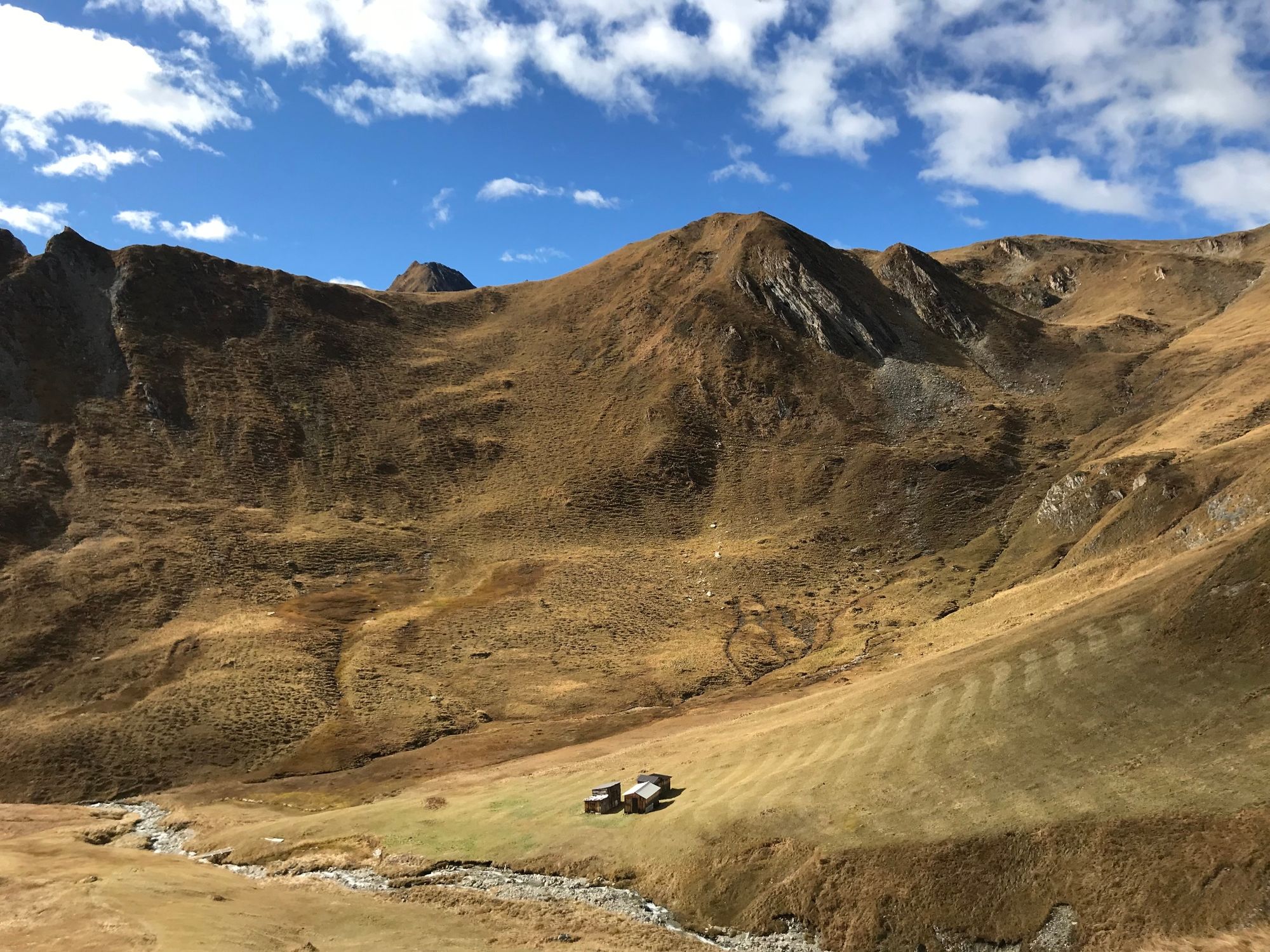
From Samnaun-Ravaisch you hike over Planer Salaas past the waterfall of the Salaaser river up to the Alp Trider saddle.
- Stopień trudności
-
średni
- Ocena
-
- Trasa
-
Hotel Restaurant Sonneck0,2 kmRavaisch (1.799 m)0,2 kmPlan (1.725 m)1,4 kmAlptrider Sattel (2.495 m)5,2 kmSattel5,6 km
- Najlepszy sezon
-
stylutmarkwimajczelipsiewrzpaźlisgru
- Najwyższy punkt
- 2.508 m
- Miejsce docelowe
-
PostBus stop Samnaun-Ravaisch, mountain railroads
- Profil wysokości
-
 © outdooractive.com

- Autor
-
Wycieczka Planer Salaas jest używany przez outdooractive.com pod warunkiem.
GPS Downloads


Informacje ogólne
Przystanek odświeżania
Obiecujący