© Graubünden Ferien - normierte Touren - Antonella Klee
- Krótki opis
-
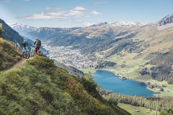
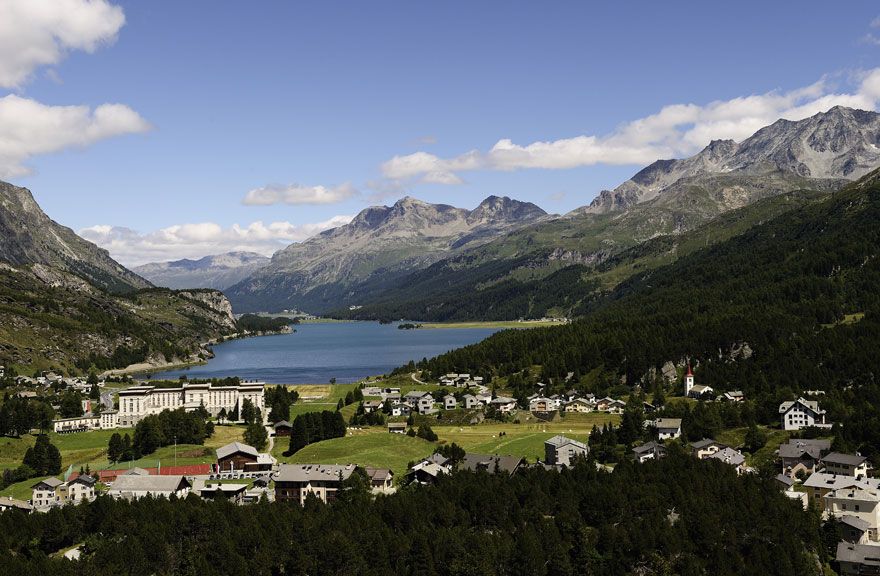
A route through a unique landscape along the rushing Inn: mighty, delicately decorated Engadin houses, clear lakes, diverse terraced landscape, an Eldorado for rare birds, noble St. Moritz, snow-covered mountain scenery.
- Stopień trudności
-
ciężkie
- Ocena
-
- Trasa
-
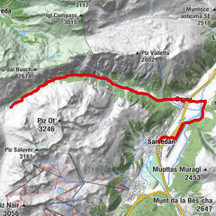
Maloja (1.809 m)Maloja PostaChiesa Evangelica Maloja0,3 kmCapolago0,8 kmSplüga2,1 kmPlaun da Lej (See) (1.305 m)3,3 kmMurtaröl3,4 kmPlaun da Lej3,5 kmClos6,3 kmSan Lurench6,4 kmDotturas6,6 kmMutals6,6 kmAlpenrose6,8 kmPizs6,9 kmReformierte Kirche6,9 kmSuot Crastas7,0 kmSils im Engadin (1.803 m)7,1 kmCrastas7,6 kmBar Cetto7,7 kmCrastas Dadour7,7 kmPas-chs8,0 kmSuot l'Ova8,0 kmDavous Sellas8,0 kmSurlej12,7 kmSilvaplana (1.815 m)13,6 kmChampfèr (1.825 m)16,4 kmKirche Sankt Karl Borromäus19,3 kmSankt Moritz Bad19,7 kmSankt Moritz (1.822 m)20,5 kmCelerina Staz (1.716 m)23,6 kmPiste 2129,0 kmLa Punt Chamues-ch (1.687 m)33,3 kmBurdun34,4 kmLa Punt34,5 kmMadulain (1.697 m)35,9 kmResgia38,2 kmCurtinellas38,6 kmS-chanf (1.660 m)40,6 kmCarolina50,6 kmHotel Pizzeria SELVA56,5 kmZernez (1.474 m)57,1 kmReformierte Kirche Zernez57,3 kmChasuot59,3 kmGüstizia60,9 kmCrusch Salet63,1 kmSusch (1.438 m)63,9 kmHatecke Ustaria Muzeum Susch64,2 kmReformierte Kirche64,3 kmLavin (1.412 m)68,6 kmPiz Linard68,7 kmReformierte Kirche69,5 kmGuarda (1.653 m)73,2 kmReformierte Kirche73,2 kmPensiun Val Tuoi73,3 kmCrusch Alba73,3 kmMeisser Dalet73,5 kmBos-cha (1.664 m)74,8 kmGletschermühle76,0 kmSchorta's Alvetern77,7 kmArdez (1.467 m)77,9 kmParadies83,0 kmMuglin (1.600 m)83,1 kmPlazzöl83,6 kmFetan (1.648 m)84,3 kmPutschigls87,3 kmHerz Jesu89,5 kmScuol (1.250 m)89,8 kmPradella93,4 kmVal d'Unia97,8 kmSur En (1.255 m)97,8 kmSper La Punt98,2 kmSan Niclà106,0 kmKirche San Niclà106,1 kmStrada107,3 kmReformierte Kirche107,4 kmS-chadatsch108,4 kmMartina (1.035 m)111,5 kmOvella114,4 kmVinadi116,8 kmSchalkl118,2 km
- Najlepszy sezon
-
stylutmarkwimajczelipsiewrzpaźlisgru
- Najwyższy punkt
- 1.853 m
- Miejsce docelowe
-
Martina
- Profil wysokości
-
 © outdooractive.com
-

-
AutorWycieczka 65 Inn cycle path jest używany przez outdooractive.com pod warunkiem.
GPS Downloads


Informacje ogólne
Przystanek odświeżania
Kulturalny/Historyczny
Fauna
Więcej wycieczek w regionach