Engadin Mountainbike Tour by Private Selection Tours

Mountainbike

© Private Selection Hotels - Private Selection Hotels & Tours

© Private Selection Hotels - Private Selection Hotels & Tours

© Private Selection Hotels - Private Selection Hotels & Tours

© Private Selection Hotels - Private Selection Hotels & Tours

- Krótki opis
-
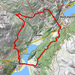
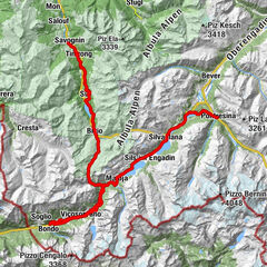
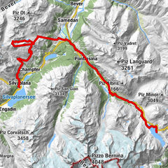
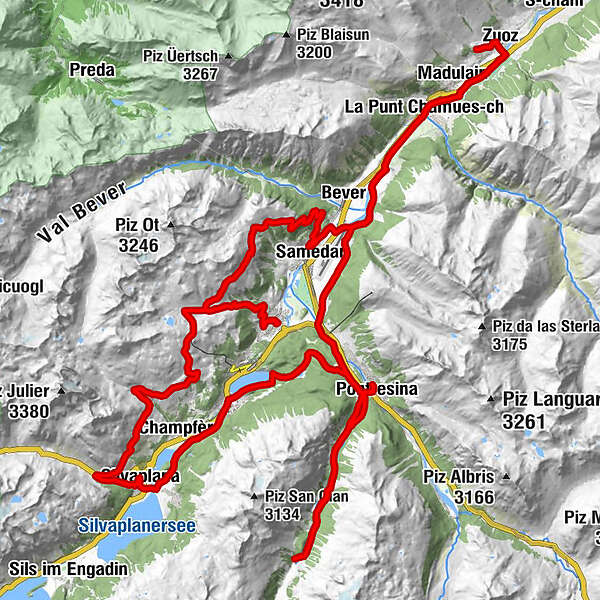
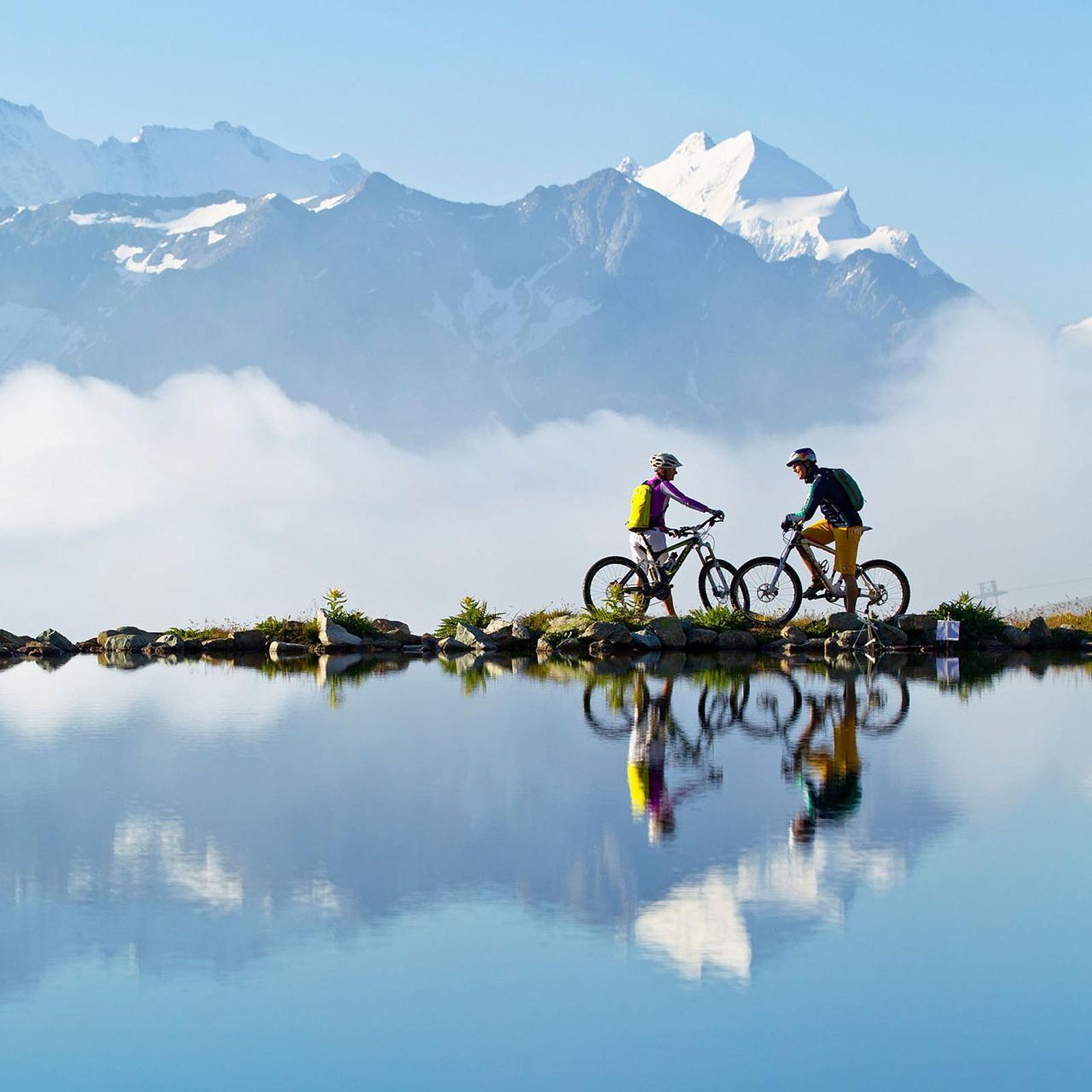
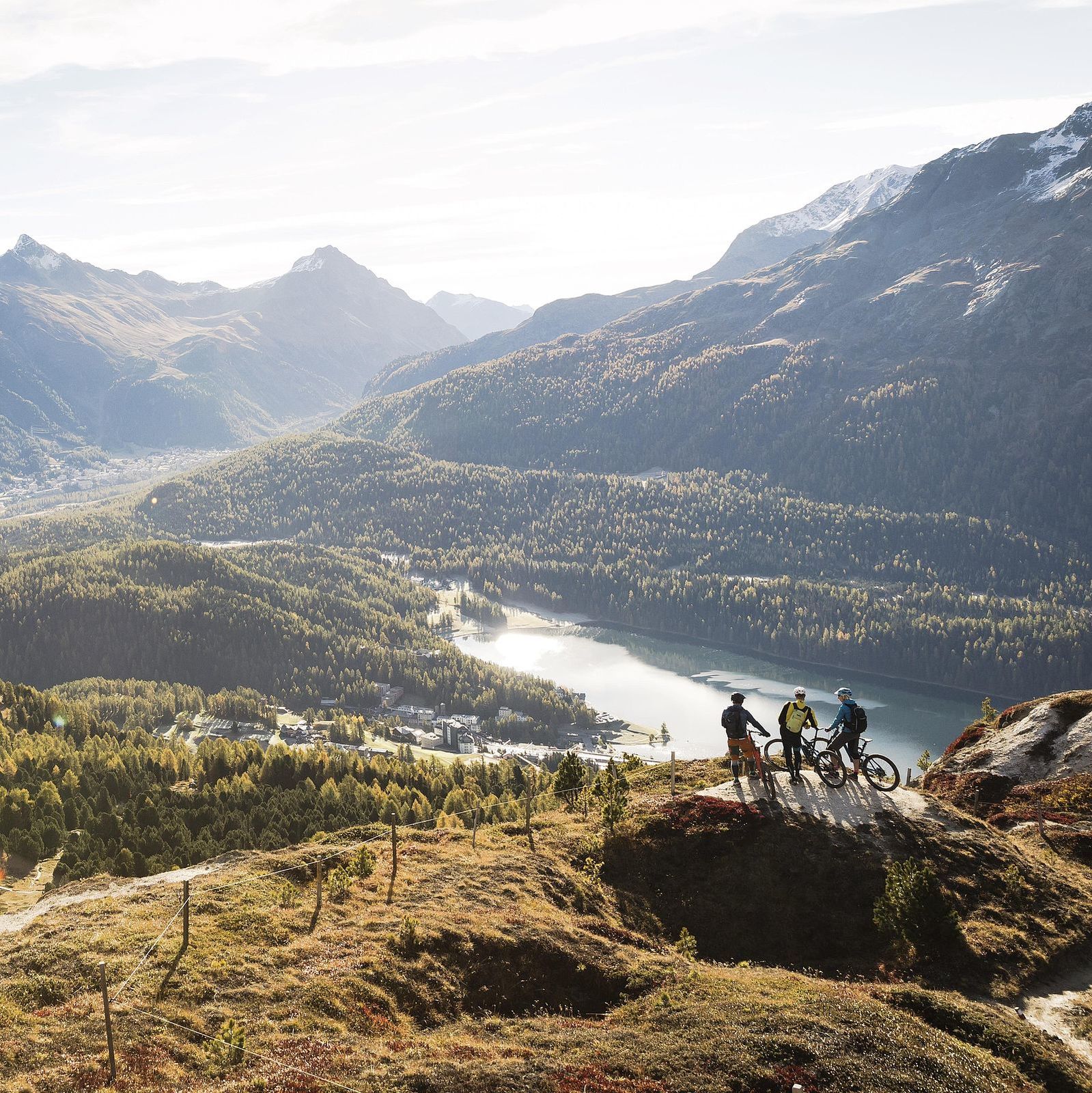
The Engadine mountains make mountain biking hearts beat faster! The circular tour contains 3 stages and takes you from Celerina via Pontresina to Zuoz and back to Celerina.
- Stopień trudności
-
średni
- Ocena
-
- Trasa
-
Celerina (1.714 m)0,2 kmCelerina Seglias (1.730 m)0,4 kmMarguns4,6 kmCorviglia6,5 kmCorviglia (Bergstation)6,5 kmWhite Marmot Restaurant & Bar6,5 kmAlp Giop8,4 kmEl Paradiso10,1 kmAlp Suvretta11,4 kmDschember16,8 kmSilvaplana (1.815 m)18,9 kmSankt Moritz Bad23,7 kmKirche Sankt Karl Borromäus24,1 kmSankt Moritz (1.822 m)24,6 kmLandgasthof Meierei26,4 kmPontresina (1.774 m)30,3 kmPontresina (1.805 m)30,8 kmHotel Restaurant Roseg Gletscher38,6 kmPontresina (1.805 m)45,5 kmPontresina (1.774 m)45,8 kmPiste 2152,5 kmLa Punt Chamues-ch (1.687 m)56,6 kmBurdun57,8 kmLa Punt57,9 kmMadulain (1.697 m)59,3 kmChapella San Bastiaun61,9 kmZuoz (1.716 m)62,1 kmDavous Crasta62,9 kmChaunt da Crusch62,9 kmPlaun Chod63,6 kmMadulain (1.697 m)66,8 kmLa Punt68,4 kmLa Punt Chamues-ch (1.687 m)68,4 kmBurdun68,5 kmPiste 2173,8 kmSamaden (1.721 m)75,7 kmMuntarütsch (1.772 m)76,7 kmAlp Muntatsch (2.186 m)79,9 kmMarguns85,7 kmCelerina Seglias (1.730 m)89,8 kmCelerina (1.714 m)90,2 km
- Najlepszy sezon
-
stylutmarkwimajczelipsiewrzpaźlisgru
- Najwyższy punkt
- 2.488 m
- Miejsce docelowe
-
Cresta Palace Hotel, Celerina
- Profil wysokości
-
 © outdooractive.com


- Autor
-
Wycieczka Engadin Mountainbike Tour by Private Selection Tours jest używany przez outdooractive.com pod warunkiem.
GPS Downloads


Pasy ruchu
Trial
Informacje ogólne
Przystanek odświeżania
Wskazówka dla osób mających dostęp do poufnych informacji
Obiecujący
Więcej wycieczek w regionach