


© Interlaken Tourismus - Mike Kaufmann

© Interlaken Tourismus - Mike Kaufmann

© Interlaken Tourismus - Mike Kaufmann

- Krótki opis
-
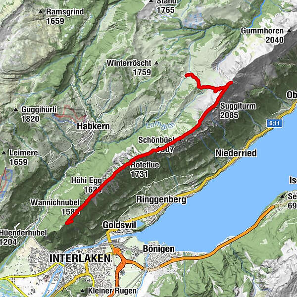
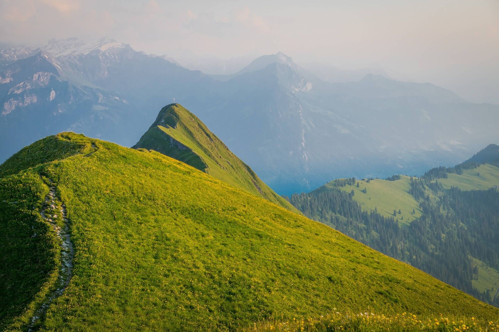
The hike offers unique views of Lake Thun, Lake Brienz and the surrounding mountain peaks. If you’re lucky, you’ll also see ibex, which will let you approach up to no more than a few metres away. In keeping with the “in nature” experience, none of the tracks are paved.
- Stopień trudności
-
średni
- Ocena
-
- Trasa
-
LombachalpAugstmatthorn (2.137 m)2,3 kmSuggiturm (2.085 m)3,4 kmSolwengen4,5 kmSchönbüel (1.807 m)5,2 kmTeni5,5 kmHoretalp6,2 kmRoteflue (1.731 m)7,6 kmHöjenegg8,3 kmHöhi Egg (1.628 m)8,4 kmWannichnubel (1.585 m)9,6 kmHarderkulm10,6 kmPanorama-Restaurant Harder-Kulm10,7 km
- Najlepszy sezon
-
stylutmarkwimajczelipsiewrzpaźlisgru
- Najwyższy punkt
- 2.124 m
- Miejsce docelowe
-
Harderkulm, Seilbahn
- Profil wysokości
-
 © outdooractive.com


-

-
AutorWycieczka Hike to see the ibex herd on the Augstmatthorn jest używany przez outdooractive.com pod warunkiem.
GPS Downloads


Informacje ogólne
Przystanek odświeżania
Fauna
Obiecujący
Więcej wycieczek w regionach
-
Obwalden
2014
-
Interlaken
1099
-
Habkern
336


