- Krótki opis
-
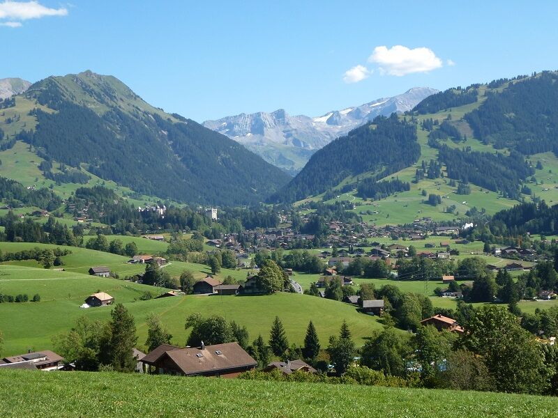
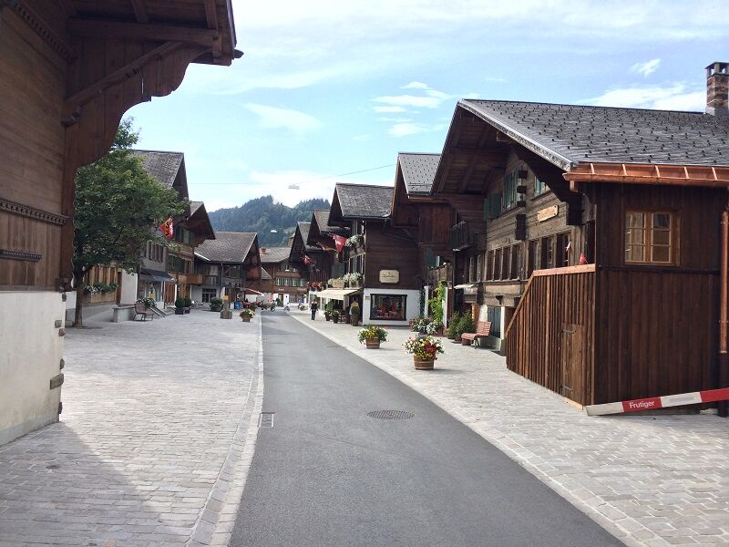
Ancient legends tell that God took a break by the creation of the world, rested and that his handprints created the Saanenland. The four valleys of the region are said to represent the four fingers of the hand. They can be combined in any way and form the basis for all shorter rides in the region of Gstaad.
- Stopień trudności
-
ciężkie
- Ocena
-
- Trasa
-
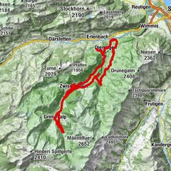
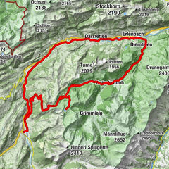
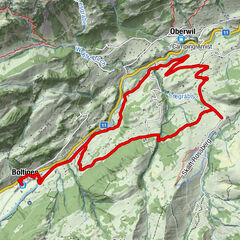
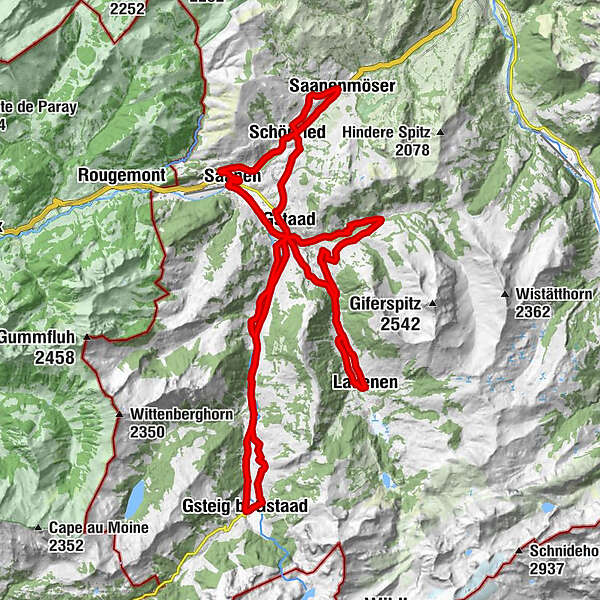
Gstaad (1.050 m)Pizerria Victoria0,0 kmEGW Evang. Gemeinschaftswerk0,3 kmSchönried (1.200 m)3,7 kmSaanenmöser6,5 kmPizzeria da Corrado8,7 kmLa Nicchia8,8 kmSchönried (1.200 m)9,1 kmAlpenrose9,4 kmHuus Gstaad11,3 kmSaanen (1.014 m)13,4 kmSaanen (1.010 m)13,6 kmGstaad (1.050 m)16,6 kmCBZ Christliches Begegnungszentrum17,6 kmTurbach20,5 kmBissen24,3 kmBadweidli24,7 kmTrom25,3 kmLauenen29,8 kmEvangelisch-reformierte Kirche29,9 kmGstaad (1.050 m)36,7 kmChesery43,4 kmFeutersoey43,8 kmGasthaus Rössli44,0 kmSanetsch47,3 kmGsteig b. Gstaad (1.184 m)47,4 kmBären47,4 kmGasthaus Rössli51,9 kmFeutersoey52,0 kmChesery52,3 kmAlphorn58,0 kmPizerria Victoria59,3 kmGstaad (1.050 m)59,4 km
- Najlepszy sezon
-
stylutmarkwimajczelipsiewrzpaźlisgru
- Najwyższy punkt
- 1.383 m
- Miejsce docelowe
-
Gstaad, railway station
- Profil wysokości
-
 © outdooractive.com

-

-
AutorWycieczka Gstaads Pédaleur de Charme jest używany przez outdooractive.com pod warunkiem.
GPS Downloads


Informacje ogólne
Przystanek odświeżania
Kulturalny/Historyczny
Obiecujący
Więcej wycieczek w regionach
-
Thyon les Collons
107
-
Destination Gstaad
88
-
Gstaad
30