Tavernes walking trail
światło
Nawigacja
Nawigacja
Pobierz tę trasę na swój telefon komórkowy
Tavernes walking trail
światło
Wędrówka
5,08
km
Zeskanuj kod QR i rozpocznij nawigację w aplikacji bergfex.

Wędrówki i tropienie


Tavernes walking trail
światło
Odległość
5,08
km
Czas trwania
01:45
h
Ascent
132
hm
Poziom morza
1 545 -
1 691
m
Ścieżka do pobrania
Tavernes walking trail
światło
Wędrówka
5,08
km
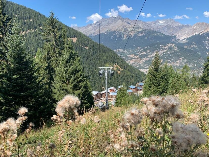
This is an easy walk, accessible to all from spring to autumn, that allows you
to gain a little height in record time.
You'll leave the resort base behind you without even having to worry about
signage...
Opis
This is an easy walk, accessible to all from spring to autumn, that allows you
to gain a little height in record time.
You'll leave the resort base behind you without even having to worry about
signage on the path. It's a trail that's easy to follow and takes you right where
you want to go in the cool of long summer evenings.
The mountain breeze heightens your sense of freedom as you walk with your
family. Going at their own pace, young and old go ambling along or fooling
around to their hearts' content. The trail passes by the Charmaix stream,
where you'll be inspired to some new adventures.
Trasa
Autor
Dostarczone przez Haute Maurienne Vanoise
Wycieczkę Tavernes walking trail zapewnia outdooractive.com.


Informacje o trasie
Trasa
To guide you in the field, consult the "step-by-step" directional diagram provided in pdf.
Wycieczka w jedną stronę
Tak
Dodatkowe informacje i wskazówki
Dodatkowe informacje
The duration of hiking trails is calculated using reference paces: 300 m/h ascent, 500 m/h descent and 4 km/h on the flat.
As hazards may occur at any time on the routes, the GPX tracks provided are not contractual. They are given for information only. Riders use them at their own risk, depending on their level of technological proficiency and their understanding of the terrain.
As hazards may occur at any time on the routes, the GPX tracks provided are not contractual. They are given for information only. Riders use them at their own risk, depending on their level of technological proficiency and their understanding of the terrain.
Nie ma jeszcze recenzji
Popularne wycieczki w okolicy
- 4,5
BARDONECCHIA Pian del Colle - Valle Stretta
średniRakieta do chodzenia po śniegu 5,02 km - 5,0
BARDONECCHIA Colle Sommeiller
średniMountainbike 25,4 km - 5,0
BARDONECCHIA Forte Jafferau Loop
ciężkiMountainbike 36,8 km - 5,0
BARDONECCHIA Green Lake
światłoWędrówka 2,14 km - 5,0
BARDONECCHIA Decauville
średniWędrówka 7,29 km BARDONECCHIA Lago Verde
światłoMountainbike 10,7 kmBARDONECCHIA Monte Jafferau
ciężkiWędrówka 11,6 km- 4,0
BARDONECCHIA Sentiero dei Cosetti by Luciano Ferraris
światłoWędrówka 3,24 km - 5,0
BARDONECCHIA Chesal nature route
światłoWędrówka 3,48 km - 4,0
BARDONECCHIA Lucianina Path - Grange di Valle Stretta
średniWędrówka 5,18 km
Wędrówki i tropienie

Ponad 550.000 propozycji wycieczek, szczegółowe mapy i intuicyjny planer tras sprawiają, że aplikacja jest niezbędna dla wszystkich entuzjastów przyrody.

Nie przegap ofert i inspiracji na następne wakacje
Zapisz się do newslettera
Błąd
Wystąpił błąd. Spróbuj ponownie.Dziękujemy za rejestrację
Twój adres e-mail została dodana do listy mailingowej.
Wycieczki po całej Europie
Austria Szwajcaria Niemcy Włochy Słowenię Francja Holandia Belgia Polska Liechtenstein Czechy Słowacja Hiszpania Chorwacja Bośnia i Hercegowina Luksemburg Andorra Portugalia Islandia Wielka Brytania Irlandia Grecja Albania Macedonia Północna Malta Norwegia Czarnogóra Mołdawia Kosowo Węgry San Marino Rumunia Estonia Łotwa Białoruś Cypr Litwa Serbia Bułgaria Monako Dania Szwecja Finlandia