Trail of Mont Saint-Rigaud - Beaujolais - Deux-Grosnes

Trailrunning

© Benoit Martin

- Krótki opis
-
The advantages of the course
Mont Saint-Rigaud: a 1009 m summit to climb easily to train and prepare for more difficult journeys. - Stopień trudności
-
ciężkie
- Ocena
-
- Trasa
-
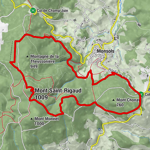
Croix des Oncins2,2 kmMont Saint-Rigaud (1.009 m)6,1 kmSource du Mont Saint-Rigaud6,5 kmCroisement des Fonderies11,7 kmBreté12,6 kmChonay14,2 km
- Najlepszy sezon
-
stylutmarkwimajczelipsiewrzpaźlisgru
- Najwyższy punkt
- 1.002 m
- Miejsce docelowe
-
Car park of the Maison de la randonnée et du trail at the Col de Crie
- Profil wysokości
-
 © outdooractive.com

-

-
AutorWycieczka Trail of Mont Saint-Rigaud - Beaujolais - Deux-Grosnes jest używany przez outdooractive.com pod warunkiem.
GPS Downloads


Informacje ogólne
Uzdrawiający klimat
Kulturalny/Historyczny
Fauna
Obiecujący
Więcej wycieczek w regionach
-
Rhône
49
-
Saône-Beaujolais
31