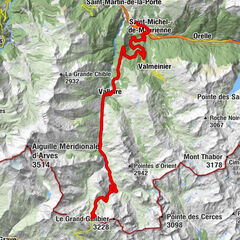
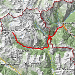
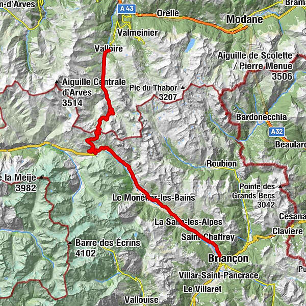
Route des Grandes Alpes - From Valloire to Briançon (8)

Droga rowerowa

© TILT COM’SEIL - Brice Milbergue

© TILT COM’SEIL - Lionel Terrail

© TILT COM’SEIL - Lionel Terrail

© TILT COM’SEIL - Philippe Lemonnier

© TILT COM’SEIL - Lionel Terrail

© TILT COM’SEIL - Lionel Terrail

© TILT COM’SEIL - Brice Milbergue

© TILT COM’SEIL - Philippe Lemonnier

© TILT COM’SEIL - Lionel Terrail

© TILT COM’SEIL - Lionel Terrail
Dane wycieczki
52,78km
1.260
- 2.634m
1.160hm
1.256hm
04:12h

TILT COM’SEIL
- Krótki opis
-
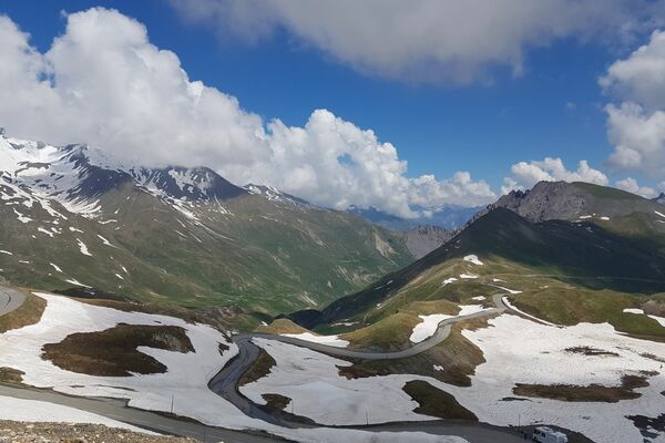
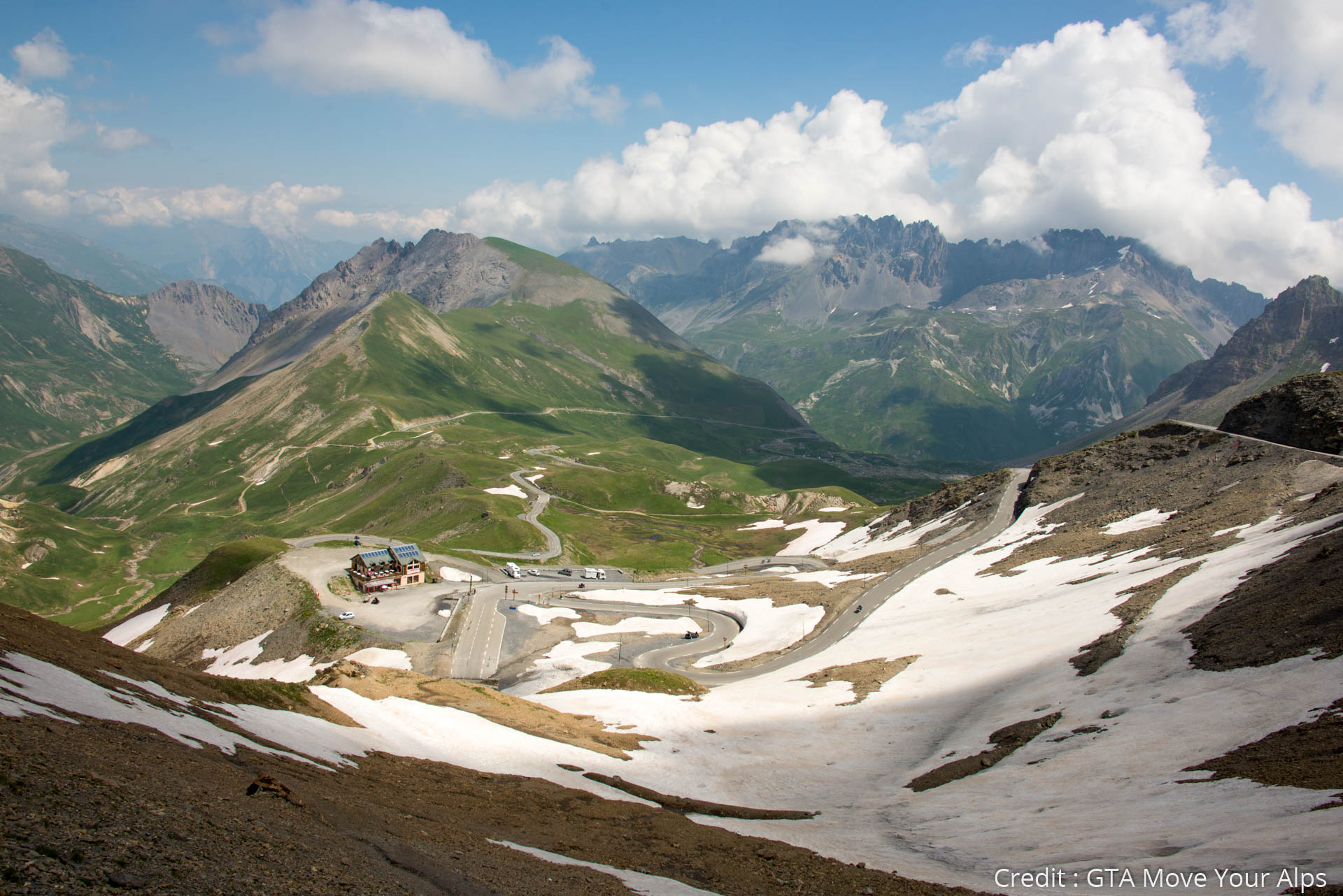
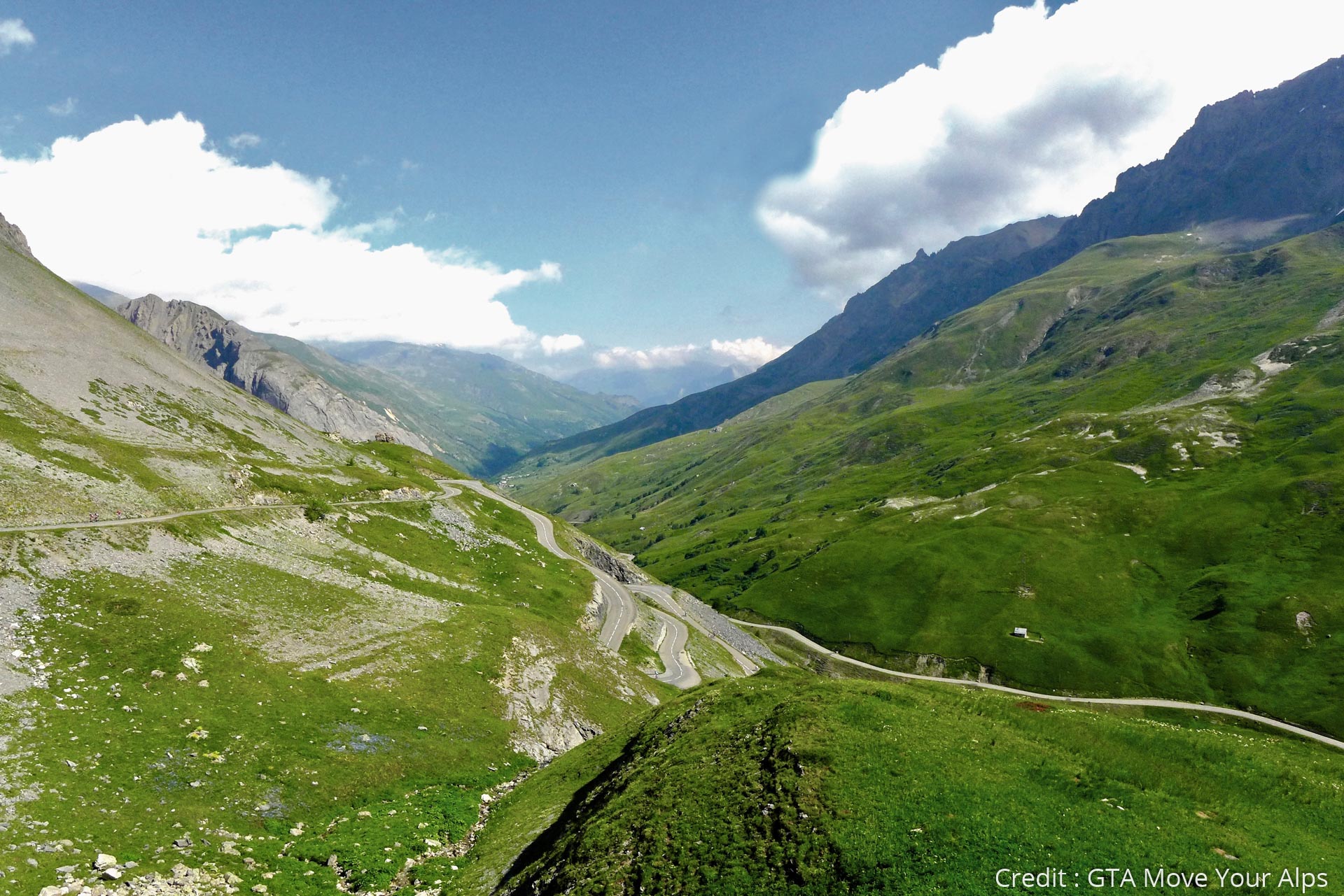
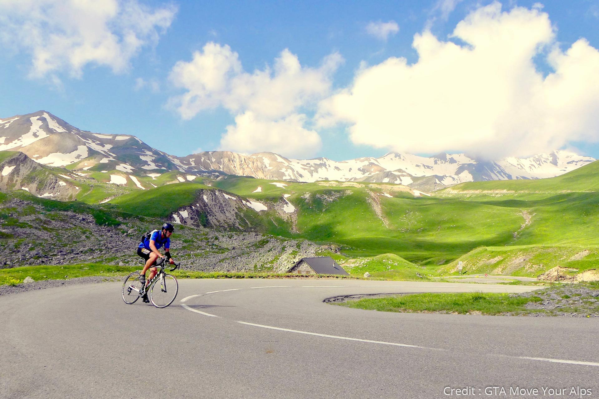
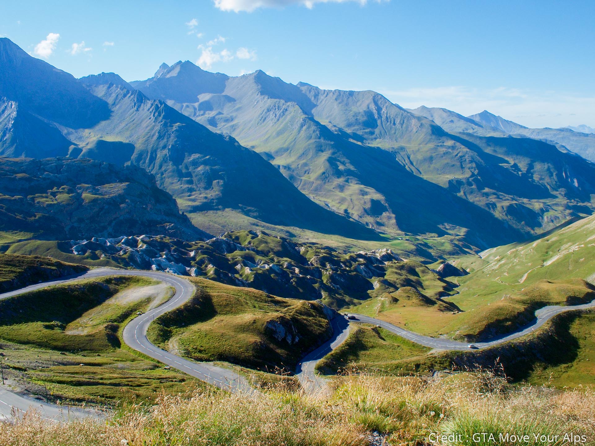
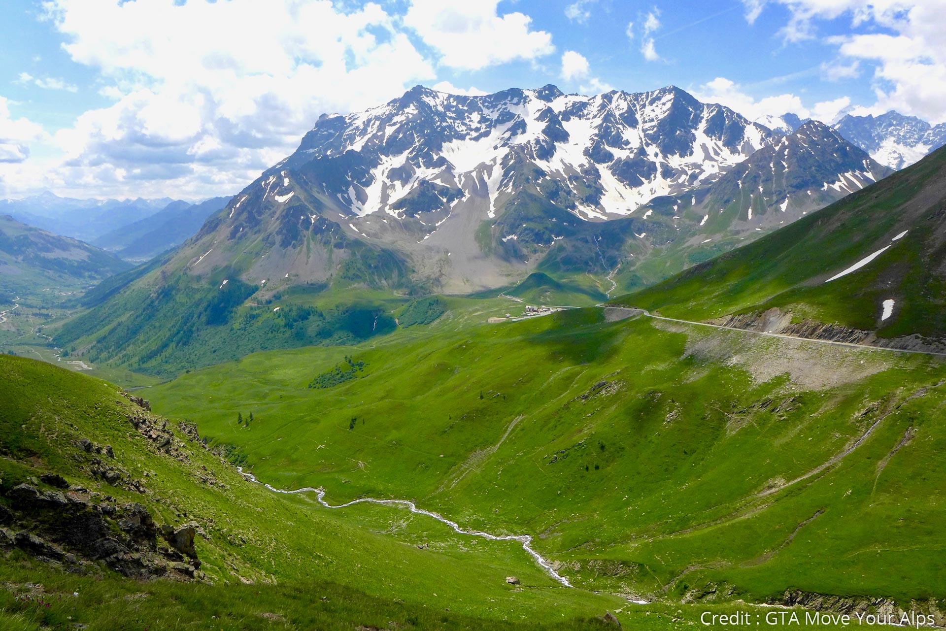
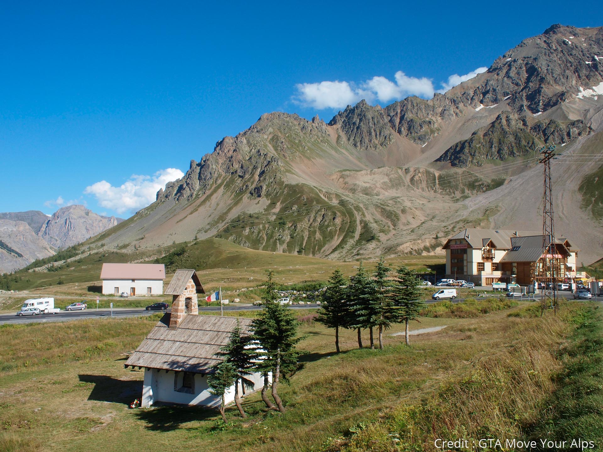
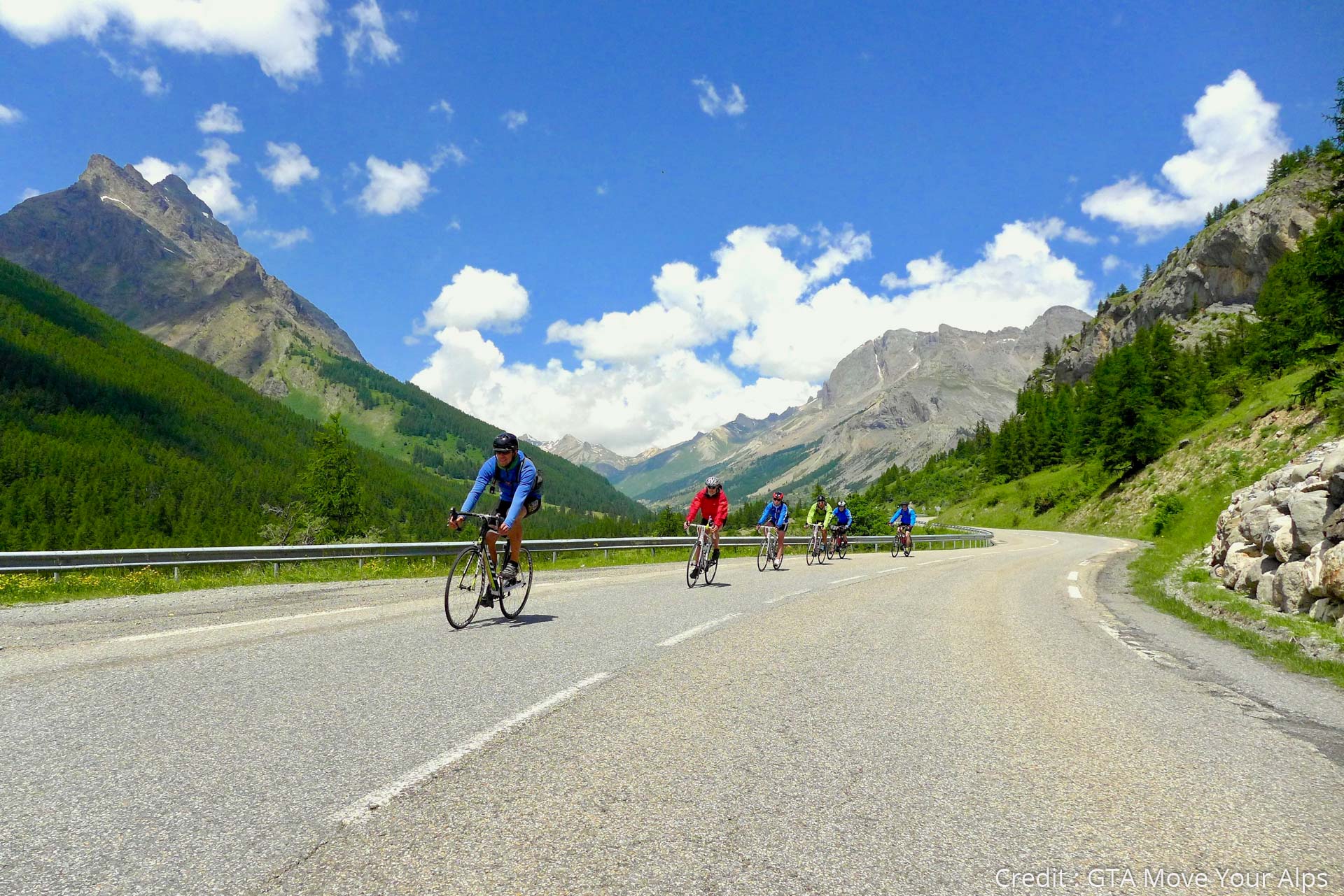
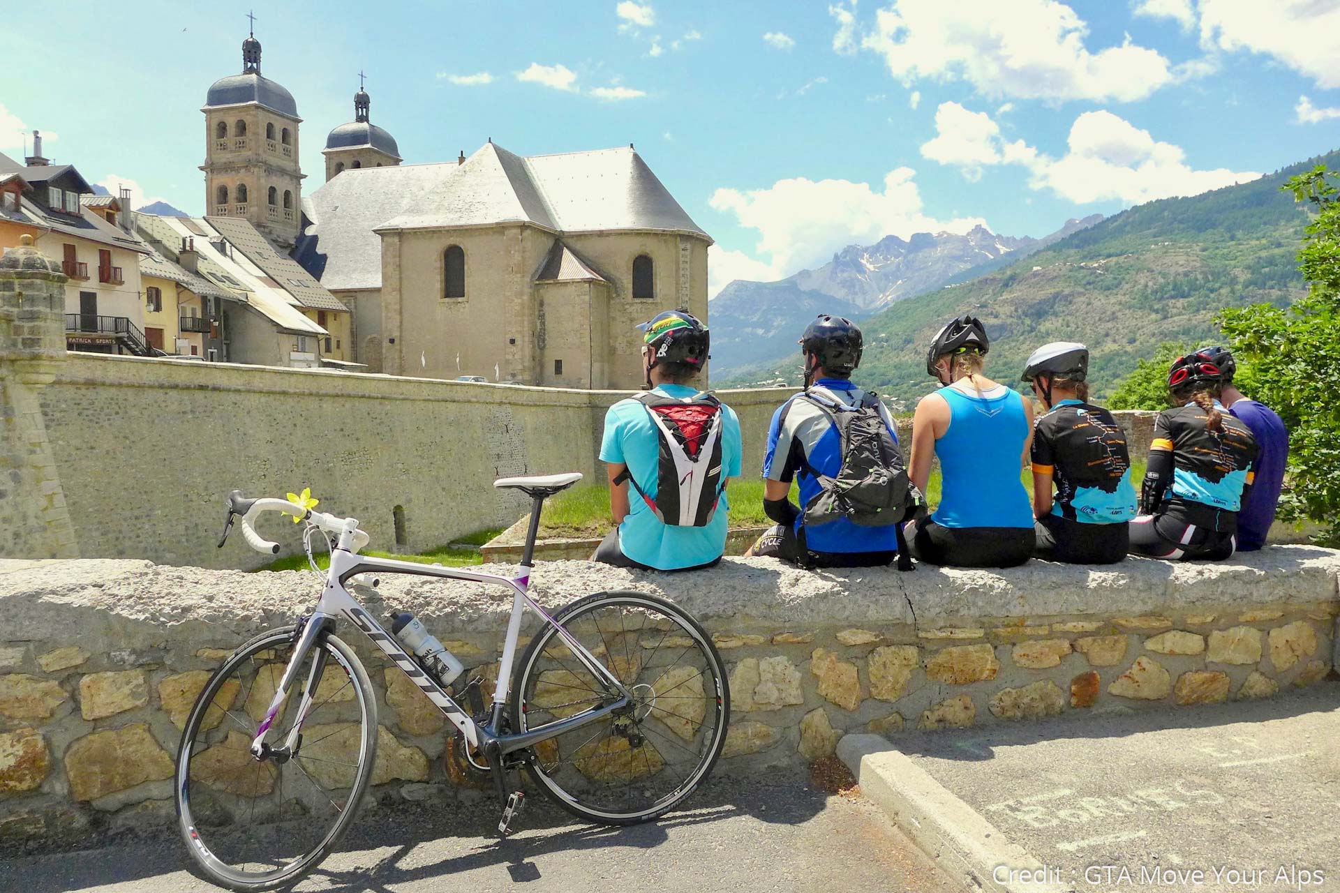
A mythical stage of the Route des Grandes Alpes with the climbing of Col du Galibier which will allow you to go from the northern part to the southern part of the French Alps and go to the fortified city of Briançon.
- Stopień trudności
-
ciężkie
- Ocena
-
- Trasa
-
ValloireSaint-RozaireÉglise de l'Assomption0,0 kmLe Praz0,1 kmLa Bonne Eau0,2 kmLa Borgé0,5 kmGrotte de la Vierge0,5 kmChapelle Saint-Bernard0,6 kmLe Crêt du Serroz0,8 kmMoulin Benjamin1,0 kmMoulin Benjamin1,1 kmLes Clots1,3 kmLa Ruaz1,4 kmLe Trappeur1,7 kmRestaurant du Crêt Rond2,2 kmLes Verneys2,3 kmChapelle Saint-Claude2,4 kmLa Rivine3,3 kmL'Auberge de Plan Lachat9,8 kmRefuge du Galibier (2.556 m)18,8 kmChapelle des Fusillés26,4 kmCol du Lautaret (2.058 m)26,6 kmAuberge du Pont de l'Alp33,5 kmLe Lauzet33,7 kmÉglise Notre-Dame-de-l'Assomption39,5 kmOratoire39,5 kmLe Monêtier-les-Bains39,7 kmLes Guibertes42,1 kmVilleneuve44,9 kmLa Salle-les-Alpes46,0 kmLa Chirouze46,6 kmChantemerle48,1 kmSaint-Chaffrey49,6 kmAuberge de L'Impossible51,6 km
- Najlepszy sezon
-
stylutmarkwimajczelipsiewrzpaźlisgru
- Najwyższy punkt
- 2.634 m
- Miejsce docelowe
-
Briançon
- Profil wysokości
-
 © outdooractive.com


- Autor
-
TILT COM’SEILWycieczka Route des Grandes Alpes - From Valloire to Briançon (8) jest używany przez outdooractive.com pod warunkiem.
GPS Downloads


Więcej wycieczek w regionach